We are pleased to be able to publish this detailed account of the Monument, newly written by local historian Georgina Craufurd.
THE BURRARD NEALE MONUMENTAL OBELISK, WALHAMPTON, LYMINGTON, HAMPSHIRE (GRADE II* LISTED): THE BACKGROUND HISTORY
Georgina Craufurd, with revisions to July 2014
- The history of the design
British travellers first met with pyramids and obelisks on the Grand Tour to Rome, where the Ancient Roman pyramid of Caius Cestius is still visible near the Porta San Paolo, and there are eight ancient Egyptian and five ancient Roman obelisks. (In fact in the Renaissance and after, both shapes were referred to as ‘pyramids’. Their geometry is very similar: obelisks are elongated pyramids.)
The obelisk was first reproduced in England without any connotations of being a memorial, and certainly not of death: Robert Dudley’s recreated garden at Kenilworth has pierced obelisks as supports for climbing plants, a feature in gardens today. At around the same time in France at the Chateau de Sully on the edge of Burgundy, a series of geometric shapes including the obelisk was set up in stone on the parapet bordering the moat. They could even be mile-stones, like the one at St George’s Circus in south London. In the earlier part of the 18th century, obelisks were seen as suitable shapes for memorials for the living: for instance the obelisk at Castle Howard (1714-15) which commemorated Marlborough’s victories, and the one erected by George II in 1760 in honour of the Duke of Cumberland at Virginia Water. Later in the century the shape was used for post mortem memorials, as on numerous Adam-style monuments in churches.
The connection with Egypt was only made in people’s minds after Napoleon’s successful conquest of Egypt in 1798-1801 and the publication at his instigation of a series of illustrations of Egyptian antiquities. This was followed by Nelson’s sea victory at the so-called Battle of the Nile (actually battle of Aboukir Bay) in 1799. Egyptomania set in, even to the extent of furniture with crocodile feet. The Egyptian Museum was opened on the south side of Piccadilly, and the double-height so-called Egyptian Hall was constructed in what was then a courtyard of the Mansion House in London. (This does not look to our eyes remotely Egyptian, but it follows Vitruvius’s description of such a building in his treatise On Architecture, written around 50 BC.) There is even an Egyptian House in Penzance, dating from 1835, whose façade is covered with Egyptian motifs, and Temple Mill of 1838-41(part of Marshall’s Mill in Leeds) is in pure Egyptian style.
In the early 19th century, numerous genuine Egyptian artefacts were brought to England, including many now in the British Museum, from Belzoni’s stay in Egypt from 1815-19. The so-called Cleopatra’s Needle was presented to the British government in 1819 (though it was not set up until 1877 on the Embankment in London). Original Egyptian obelisks are usually inscribed with hieroglyphs and made of a single block of stone, which makes them very difficult to make and transport. They do not have a plinth between them and the ground. In contrast, most European obelisks are plain and are built of coursed masonry; they usually have a plinth, which serves to set them off and provides a convenient place to put an inscribed tablet. A Hampshire example (commemorating someone by then dead) which precedes the Lymington one is one that was erected to Charles James Fox (1749-1806) in what is now Mayfield Park, Southampton, in 1810. Its plinth is in Classical style.
- The monument’s purpose
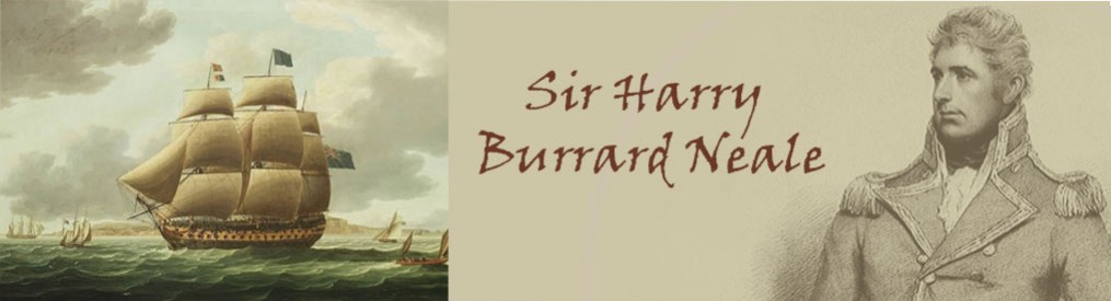
The Burrard Neale monumental obelisk was set up as a memorial to Admiral Sir Harry Burrard Neale, Bt., GCB, GCMG, (originally Burrard, born in 1765) in 1840-42 by his brother George after Sir Harry’s death in 1840, at the instigation of the local community. (A copy of the Public Testimonial which lists subscribers to the fund is in the St Barbe Museum, no. 2011.92.1.) The family lived at Walhampton House (now Walhampton School) and the land on which it stands belonged to the estate at the time. The monument now belongs to Lymington Town Council. It is 76 feet high (see Blake Pinnell, Country House History around Lymington, Brockenhurst and Milford-on-Sea, 1987, p.58, and S. Burrard, Annals of Walhampton, 1874, p.158) and is made of gigantic blocks of fine Foggintor (Dartmoor) granite ashlar. (This same stone was used for Nelson’s Column; see The Builder, vol.9. p.855 for 20 Sept.1851.) The shaft is plain, except for a low-relief on all sides just below the top depicting the wings of Isis flanking the sun’s disc.
Sir Harry’s career in the Royal Navy had been outstanding. He captured or sank no fewer than twenty French ships, and he helped to quell the Mutiny at the Nore in 1797 by the use of guile. Other ships in the fleet were blockading the Thames and threatening an English version of the French Revolution eight years before. Burrard Neale talked to his crew and found that they did not want to join the mutineers, so he suggested a plan. He himself would hide out of sight, while the crew told the mutineers that they would join the mutiny. As soon as his ship was out of cannon-shot, she sailed away to raise the alarm, and the mutiny was put down. (See S. Burrard, Annals of Walhampton, as above, pp.127-8.)
Besides the monument’s role as a memorial, it is said in addition that it was also designed to act as a sea-mark. It would have been useful to mariners, since the wooded coast from Keyhaven to Calshot is otherwise featureless, and the water on the mainland side is shallow. Early views of the monument, as will be seen below, show that the area around it was perfectly clear for most if not all of the 19th century. By the end of the century the large Trinity House marker buoys would have been laid on each side of the deep-water channel, and the sea-mark would not have been so important.
- Description of the Monument
The plinth unusually is designed to look like an Egyptian doorway, with the four inscribed metal plaques, one on each side, taking the place of the doors. The inscriptions are located to face a suitable direction. That describing the admiral’s naval achievements faces south, out to sea, while the one facing west describes his civic achievements as an MP etc. (He represented Lymington for twenty-five years over a period of forty years.) The one facing east towards Walhampton Park refers to his virtues as a land-owner, while the one facing north describes his character as a man.
The plinth itself tapers like an Egyptian doorway and has a gadrooned cavetto cornice. Embedded in this above each ‘door’ again is a motif of the wings of Isis flanking the sun’s disc. Both these last motifs are connected with rebirth or resurrection. This plinth in turn sits above four steps with sloped treads. There are the remains of the wrought iron railing around the base, removed as metal salvage in the early stages of WWII.
Above the plinth on the east side is a small plaque, set against a flat stone resembling a sarcophagus in outline. The badge, surrounded by a laurel wreath, looks very like the sort that ships of the Royal Navy have; in this case it may be that of HMS San Fiorenzo, the ship that Burrard-Neale commanded at the time of the Mutiny at the Nore in 1797. The motto TRIA + JUNCTA + IN + UNO is that of the Order of the Bath, which however has three crowns within the motto rather than a lion rampant; further research is needed. The motto would have been suitable, since Sir Harry Burrard Neale had been made Grand Commander of the Bath, an order which had been founded by George III.
As far as can be seen the admiral, though he amassed a modest fortune from naval prize money, was not at the battle of Aboukir Bay, nor does he seem to have had a particular connection with Egypt. (He may have known a colleague, Admiral Smythe (1788-1865), who commissioned the Egyptian Seat at Hartwell House in Buckinghamshire, but this was not constructed until 1850.) Given that Sir Harry’s brother the Reverend Sir George Burrard was closely involved in the erection of the monument (though one of the inscriptions credits local townspeople with the impetus for a monument of some kind), we must conclude that the form it took was George’s choice.
On the east side of the monument the riser of the top step has two shallowly carved inscriptions. The southerly one names the builder as George Banks (1807-90), son of George Banks, a Lymington bricklayer. On the northerly one is the inscription “GEORGE DRAPER / ARCHITECT”. The latter (1794-1874, according to W. Sussex Record Office Cutten Mss 1A/1/1/5 1514.19) practised largely in Chichester; his design triumphed over that of William Railton, the successful designer of Nelson’s Column that same year. The fashion for things Egyptian was paralleled by the Wellington Monument near Taunton, Somerset, which had ‘Egyptian’ details added in the course of development of the design; this was built from 1817 to 1854.
Apart from a large lump of stone which has been knocked from the cornice on the south side, probably by a falling tree branch, and water-stains from behind the panels of inscription and elsewhere, the monument looks to be in surprisingly good condition. (The missing piece of stone may be the one in the possession of the Town Clerk of Lymington at the Council’s Woodside depot.) Construction must have posed a considerable challenge; as mentioned above, most English obelisks are built of coursed masonry, each stone being of manageable size. The Burrard Neale example however is built of gigantic blocks of granite, two to a course; each block is 66 by 33 inches (168 by 84 cm), in height around 40 inches (100 cm); this would necessitate some form of powered crane. Steam cranes were not in use before the 1890s; the most likely lifting gear would have been a shear-legs type of crane to gain the necessary height, while a series of pulleys would have introduced gearing and a hand-powered windlass would have winched in the rope cable. (The remains of a Mediaeval wooden crane were found on top of the unfinished west tower of Strasburg Cathedral in the nineteenth century, so human- or animal-powered cranes were common in 1840.) The obelisk is too narrow to have internal stairs. (See J.G. Landels, Engineering in the Ancient World, 1978 repr. 1997, pages 84-90 for this topic.)
- The setting of the Monument
The setting of the monument is interesting. It is not in fact aligned with the cardinal points of the compass (north, south, etc) in contrast to the assertion of Burrard’s Annals, page 158, but rather with sides that are parallel to the river and the coast; this means that the side facing Walhampton Park for instance faces east-north-east. But for the sake of convenience this article will refer to this side of the monument as its eastern side, and will refer to the other sides similarly.
The public footpath which leads up to it from Undershore (and is now part of the Solent Way) may have originated from the location of the ferry from Lymington town quay (still remembered in the name of Old Ferry House on the river-side of the Undershore road). It is possible that the path continued eastwards along the dog-leg of Monument Lane (now asphalted), and continued further eastward at the corner where the modern road turns north towards the Walhampton Arms. This would have taken the path across Burrard land, which would not have been popular with the owners, who may well have diverted it to the south where the Solent Way now continues eastwards across the southern edge of the golf course. This section is sunken and below the curve of the hill; people walking along would not have been visible from the grounds of Walhampton House. (It too needs drastic clearance from nettles and what look like Giant Hogweed.)
West of the monument the land falls sharply away towards the river; the steepness of this slope is largely the result of human intervention, as it consists of brick-clay, which has provided the building materials for much of Lymington, no doubt. (On a map of c.1820 the area above Walhampton Lodge on Undershore is marked as a brick-yard, and the cottages which preceded the house as brick-makers’ cottages. More clay may have been extracted after the monument was built; this would have lessened the distance of the monument to the edge of the hill.) Another result of the under-layer of clay may be the present dampness of the path.
The monument seems to sit on top of a small mound at the lip of the hill, an area sometimes referred to as Mount Pleasant. (This is confusing, as the road going north-west from Buckland Rings is also called that.) Given the total weight of building materials and the lack of any sign of subsidence, the ‘mound’ in fact conceals a substantial foundation in the form of eighteen feet of masonry, according to a contemporary account. This was later concealed by earth and grass. No engineer would have wanted to plant trees into such a foundation. In C.Hallmandel’s lithograph, of which an example is in the St Barbe Museum (no. 2002.140.67) and was reproduced by Blake Pinnell on page 59 of the first edition) the slope of the mound is shown planted with ferns, with grass on top; this may have been artistic licence, but the artist has included the small detail of the badge on the east side, so the print was reasonably faithful. Pteridomania – the mania for collecting ferns – was in full force at the time.
The monument is also at the point where the land starts to slope southwards down to the ferry terminal; so the effect of its height would have been lost if it had been placed further south. It appears to be lined up in an Italian-style sistemazione on the High Street of Lymington; this is something of an illusion, as the view of the monument is lost if one is west of the entrance to the Angel Hotel. This, however, may not have been important in the early 19th century, as this point of the High Street was the site of the old Town Hall, and the burgesses of Lymington (who also elected Harry and later George Burrard to Parliament) would have been able to see the monument from their headquarters. This same Town Hall had been built by Burrard Neale’s ancestor Paul Burrard, in 1710. (See Edward King, Old Times Revisited in the Borough and Parish of Lymington, Hants, 1900, p.92 footnote.)
Today one can only see the top two-fifths of the monument, as the lower part on the south and west is shrouded by trees. This is in contrast to the situation in the 19th century; a watercolour entitled Isle of Wight from Walhampton dated 1854 by Louisa Paris, a friend and guest of the Burrard family, from the north-east shows a clear view down to the Needles on the Isle of Wight, with a clear space around the monument; only one tree is shown, at a modest distance from the monument itself. (This is in the Towner Art Gallery, Eastbourne.) An engraving by Rock & Co. of a similar view of the monument dated 20th August 1855 (St Barbe Museum no. 2002.140.29.7) which was used as a letterhead on writing paper, and which was reproduced in a booklet of Views of Lymington, published in 1863, again shows a clear view both out to sea and in the direction of the town.
This situation was still much the same when a hand-coloured photographic postcard of the monument showing both sets of railings (see below) was produced c.1900; one of the copies in the St Barbe Museum’s collection (no.1997.153.482) is conveniently postmarked 1907. There are still no trees west of the monument, while the trees which by then had been planted on the mound are still only about 30 feet (10 metres) in height. (The engraved view towards the monument in the St Barbe collection which has a pen-and-ink inscription ascribing the drawing to King in 1857 (see C.P.Jones, History of Lymington, 1930, facing.193) is however only a modern reconstruction.) A clear view from the monument to the town bears around 305 degrees. Felling trees will obviously be controversial, but it may be that some removal of odd branches and perhaps crown reduction may be enough to restore the classic view of the Monument from the Town and the Sea.
The setting would also be enhanced if railings could be put back which would resemble those on the c.1900 postcard. These show a continuous line of wrought iron railings with spear-head tops, supported at intervals by larger iron posts in the form of nautical tridents, in homage to Burrard Neale’s career. The line is interrupted almost in the middle by a kissing-gate opposite the path which is shown leading to the monument. The railings around the monument had similar finials on the supports at the corners. The continuous stone bases for the railings survive. (The present odd lengths of barrier on the edge of the road do nothing to enhance the setting.)
- The associated footpath (now part of the Solent Way)
The postcard referred to above also shows what appears to be a gravelled path which starts at the kissing-gate, then forks, with one arm leading up to the monument, while the other leads around to the right, following the line of the present path. A mid-nineteenth-century view across to Lymington (in the St Barbe Museum, no. XXX) shows the path lower down the slope, where it describes an S-curve, in much the same way as it does today. It is possible that this gravelled surface may still survive under the humus and mud. This happened at the Lost Gardens of Heligan, and was also our experience at East Grove, where we only had to scrape away the top layer of leaf-mould and give a small dressing of fresh gravel to restore the Victorian paths. Certainly the path on the slope below has a fine ballast surface under the mud and humus.
What will be necessary however is to direct surface water off the path at intervals by means of shallow gullies at an oblique angle to the line of the path; this solution is often found in Germany and Austria, for instance in the park at Bad Ischl, the country home of the Hapsburgs. At the moment the banks which flank the path hold in any water rather than let it escape.
A full review of signage is also necessary, but this will be covered by those who specialise in this area of expertise. If the Council is agreeable, a brown sign might be put on its land on the main road where the private road leaves it, directing walkers to the “Monument via footpath”. The County Council can only put signs on the actual footpath. A similar scheme is needed for the eastern section of the path, which officially only starts just east of a house called Halyards; so it is quite out of sight from Monument Lane.
- The Monument’s context in the commemoration of Burrard Neale
The monumental obelisk was listed on 8th April 1976 as Boldre parish (Dist.126)126/14/33. Its listed value is enhanced by being part of a group of items associated with Burrard Neale. This includes a plaque to Burrard Neale’s memory in the parish church of St Thomas, Lymington, and the unique cast iron gas-powered double street-light in the form of a Doric column now next to the Royal Lymington Yacht Club. (The glass shades are probably not original.) This originally stood next to the 1710 Town Hall in the middle of the High Street, with a contemporary inscription crediting Burrard Neale’s generosity in paying for street lighting in Lymington. When the Town Hall was demolished in 1858 the light was moved to near the church, and in the twentieth century it was again moved to its present position. (See Jude James, Lymington, An Illustrated History, 2007, p.92.) One wonders if it was originally on a stone plinth; it is lower in height than one would expect to be effective in shedding light. The other street-lamps given by Burrard Neale were more traditional; an 1832 print of the High Street looking westward towards the church from Grosvenor House shows taller and slimmer single lamp standards of a shape which we would associate with the Victorian age, and of which many survive today.
- The Monument’s context as part of the Walhampton House designed landscape
The gardens and park of Walhampton House, seat of the Burrards, has evolved over centuries, and it is sometimes difficult to date individual features. It must be significant however that the Monument would have been visible from the house at a rough 45 degrees to the façade, and would have balanced the laurel-covered Mound across the other side of the main view from the house at a similar angle to the façade. (Indeed the two features may have been visible from each other before the trees grew up.) Such an arrangement is often found in ‘Capability’ Brown’s 18th century landscapes as a means of giving form to a panoramic view, and his techniques were followed for decades after his death. From the evidence that survives, the Mound also seems to date from the 19th century.
Georgina Craufurd
(with thanks to Jude James for material, and to the St Barbe Museum for its help)
